Navigating Geographic Challenges in Products - Accuracy and Precision

Welcome back to my series showcasing issues I've frequently encountered in my professional work that are seemingly obscure outside the geography community. In the first post, I discussed the basics of map projections, and in the second post I touched on choosing the right map projection. This time around I'm putting a spotlight on the concept of accuracy and precision, or in the phrasing I typically use "accuracy versus precision" because they always seem to be at odds with what I'm trying to communicate to my stakeholders and what they're trying to tell me.
I'll be honest up front — I'm skipping right over the concept of coordinate systems in this article. That's a deep, technical topic that may not be beneficial to cover with stakeholders (your development team on the other hand will love it). I'm assuming that you and your customers have seen a decimal coordinate before. If you've ever done more than three clicks on any mapping product, you've seen them.
Precision and accuracy
Every time I'm asked, "how accurate is the data?" I shift the conversation to precision. The discussion of accuracy is best done with the originator of the data collection, as it's highly dependent on the methods and technology used. Depending on the product you're working on, you may not know any of this information. But you can arm yourself with knowledge about precision to address the concerns of your user.
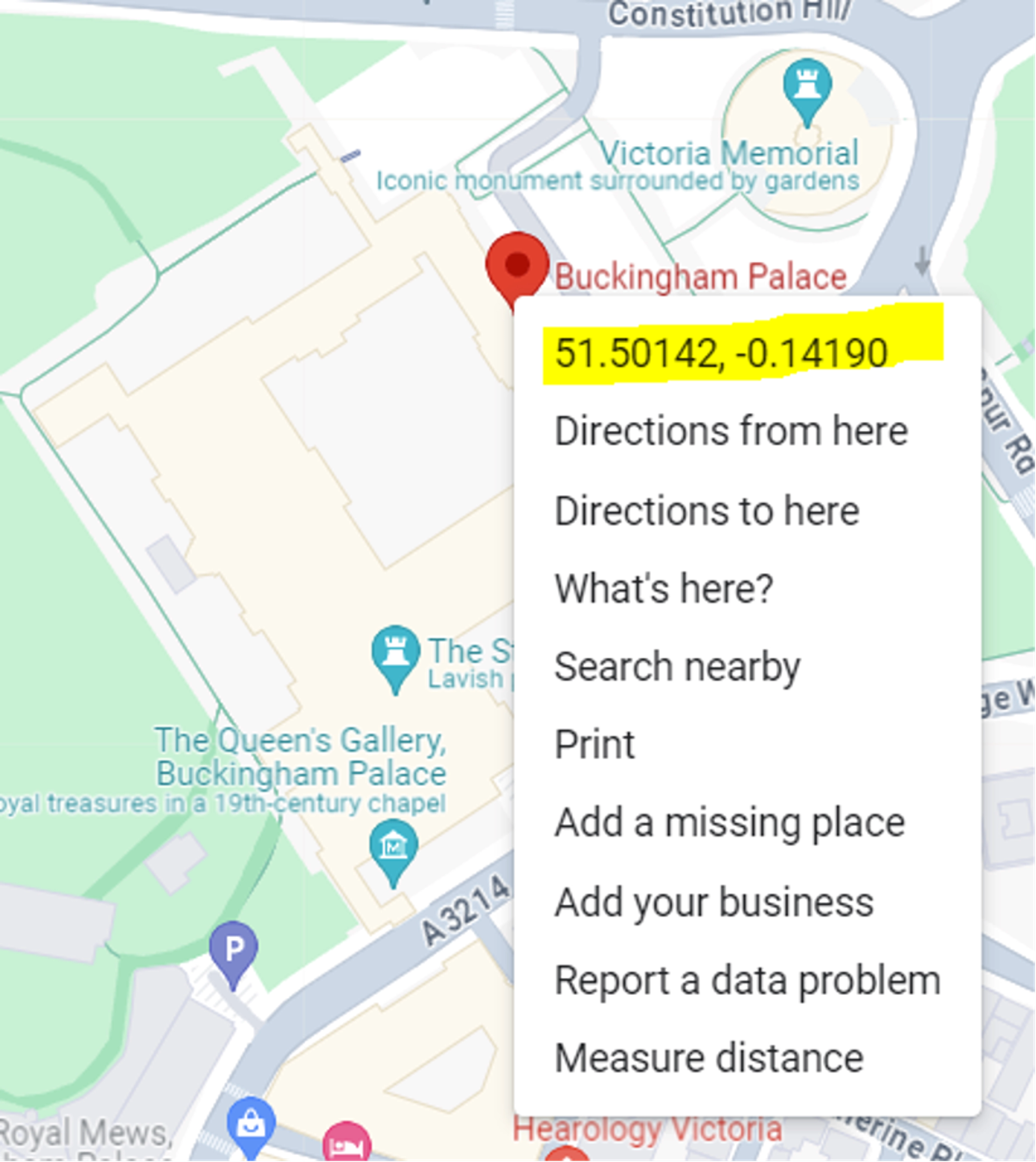
How much precision do you need?
At the equator* the decimal precision of a coordinate is as follows:
As a product manager, you need to understand how your customers are using your product. If they are simply looking at neighborhoods for crime data or landmarks for informational maps, precision to the fourth or fifth decimal is more than enough. Limiting the number of decimals used when applicable will save you database space and processing time. If your users are tracking human or animal movements, going to the fifth or sixth decimal place is preferred.
Depending on how the data you are using is collected, anything from the eighth to tenth decimal place are junk digits provided by the equipment or software. Size differences at the ninth and tenth decimal places are microscopic and not even perceivable with our naked eye so you might not need these saved for your users. If you are using data collected by such sensitive equipment, you're probably not displaying it on a map and are using it for calculations and other visualizations.
Make a decision
Users like seeing lots of decimal places on a coordinate, even if they aren't using them, as it makes the data feel very accurate. Users will conflate accuracy and precision, and use their perception of what it should be. So even if the data is set to the needed precision, they may question its accuracy. Find the appropriate channels of communication to inform them why there is a certain precision to the data that was selected.
What does your customer use?
As shown above, if your map is focused on large areas, your customer isn't actually using all the precision available in coordinates and is a candidate for having smaller coordinates.
What does your customer need?
If your customer is using the coordinates for geospatial calculations, consider preserving the entire coordinate precision for them. If your customer is just viewing and clicking on the map, only keep the precision the platform needs.
What does your customer see?
Find ways to strike a balance if your use case calls for it. Show the client an abbreviated coordinate to make it more human-readable, but allow the download or alt text of the full coordinate.
Author's notes:
For a literal definition see Precision & Accuracy because this article focuses on its use in geographic coordinates. This is why you don't see the typically used bullseye illustration
*Because the earth is a geoid (spherical) this value decreases away from the equator and varies per latitude