Navigating Geographic Challenges in Products – Geopolitics
This post breaks the mold of other topics I've covered to date because geopolitics isn't obscure — it's just not something most product managers want to think about when they consider map projections. But you must. You didn't become a product manager because you enjoyed the current events module in Social Studies class or joined Congressional Debate and Model UN clubs. That's just some of us.
By their very nature, maps are a visual representation of the creator's geopolitical worldview. What political or geographic entity is the map centered on? What areas are distorted? What names are used? What areas are omitted? What borders are solid or dashed?
If you have a scientifically-based product, you can dodge many of these issues by selecting world map projections with little-to-no borders, geographically centered on the area of interest, with an extent limited to prevent users from panning too far. The rest of us are not so lucky.
You could provide users with the ability to set a worldview at the organizational level. This ensures users of your product within that organization see the basemap per their requirements. Your product could take it a step further and allow individual users to set their worldview. Otherwise, work with your marketing and legal departments to create a pre-written explanation you can provide to customers when asked about the map projection choice you've made.
As part of this explanation, be sure you've evaluated your map provider because you will need to justify it to your customers. Besides the typical considerations of cost and implementation, ensure you've researched which worldview(s) are used. If there is only one set of boundaries provided, ensure they align with your customer's needs. Check out these resources:
- Mapbox allows users to toggle between worldviews
- Google adjusts the map depending on the viewer's location
- OpenStreetMap (OSM) uses de facto and on-the-ground guidance to avoid contention
- Esri shows the US/International worldview but their Living Atlas provides any other layer you may want
- Consider country-specific map providers like Naver (South Korea), Baidu (China), Vietbando (Vietnam), Yandex (Russia), etc.
As always, know your user! Do the appropriate research on your users to see what sort of topics may be sensitive. Some groups are more accustomed than others to seeing discrepancies (like the Irish with Derry and Londonderry), while for others, it's a legal concern in their respective country (like India's territorial disputes).
While not a comprehensive list, the points below highlight some tricky spots you may encounter when selecting a map projection, especially for border representation:
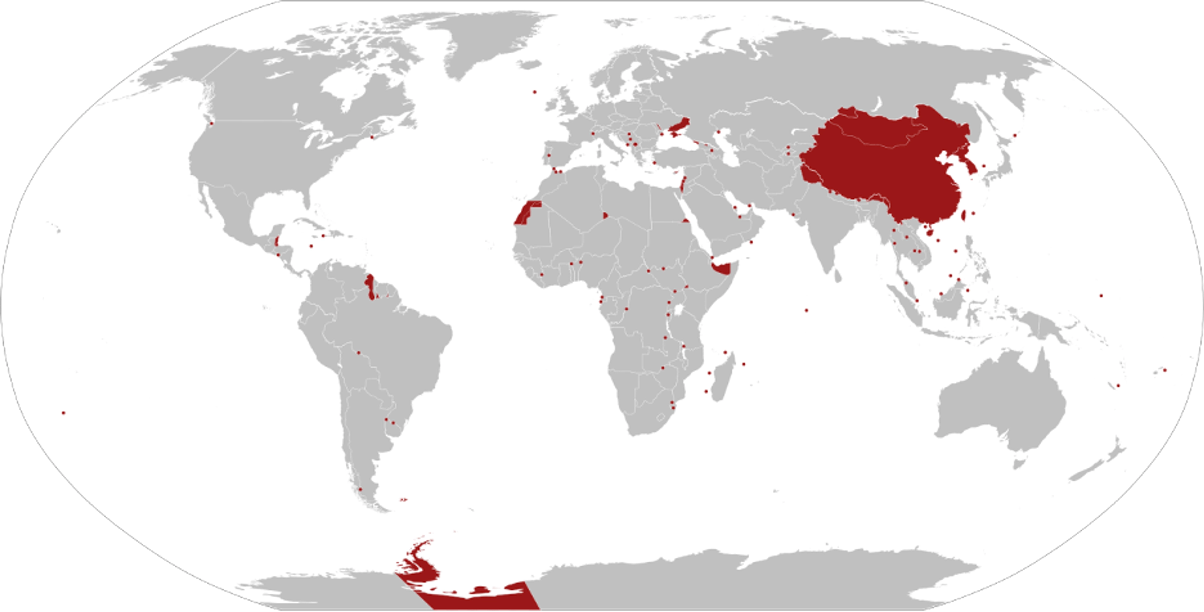
- China designated itself a "near-Arctic state" and has a specific projection for naval use as a result [IMAGE]Vriesema-Chinese vertical map, April 2017 kopie
- India has threatened fines for perceived misrepresentation of its territorial claims
- Morocco and Western Sahara have a contested border often missed on international maps but the U.S. agreed to a "new official" map in 2020
- Serbia does not recognize Kosovo's independence
- Israel and Palestine are geopolitically charged areas, in both depiction of borders and in words used to describe settlements and kibbutzim
- The UN maintains a buffer zone and peacekeeping force in Cyprus, separating Turkish and Greek Cypriots
- Due to the ongoing conflict between Ukraine and Russia, even OpenStreetMap is not updating borders
- Until recent escalations, most were probably unaware of Venezuela and Guyana's dispute
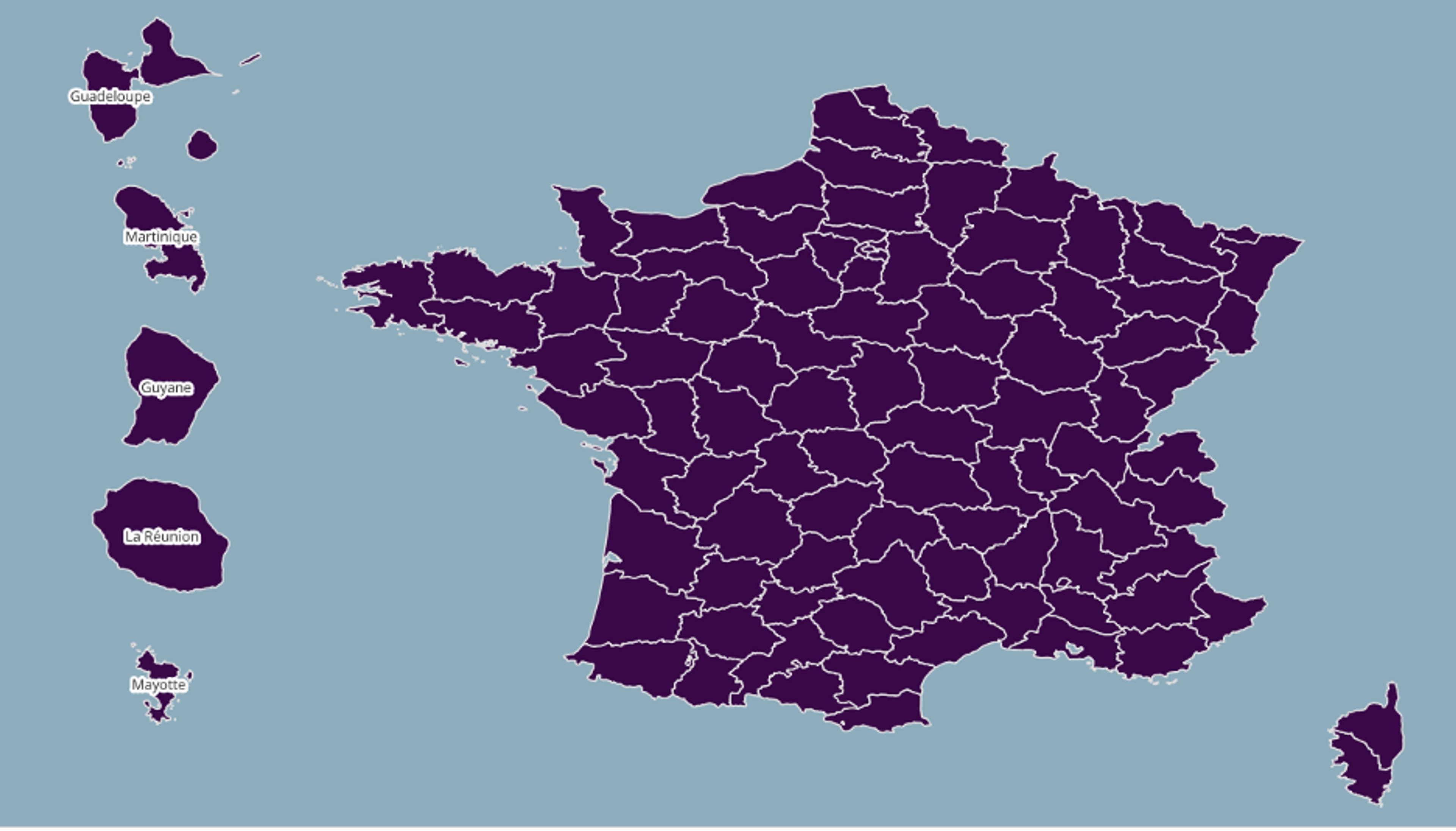
- For overseas territories (U.S., France, U.K., Netherlands, etc.) it is usually about inclusion from those who live there and negligence of the majority to depict them as such
The French have GeoJSONs that will distort overseas territories (Outre Mer) to accommodate all of France in one view. But even this one doesn't have New Caledonia, Saint Barthelemy, Saint Martin, Wallis and Futuna, or French Polynesia.
To end on a lighter subject, it's not always about borders and conflict, but sometimes perception and orientation. As a child learning to navigate in the Chicagoland area, my dad always had me find the Lake or the sunrise when I got lost. It wasn't until a few years ago did I see for the first time how I'd navigated my world — to have our perception of our homeland validated. Done simply by changing East to orient upward.
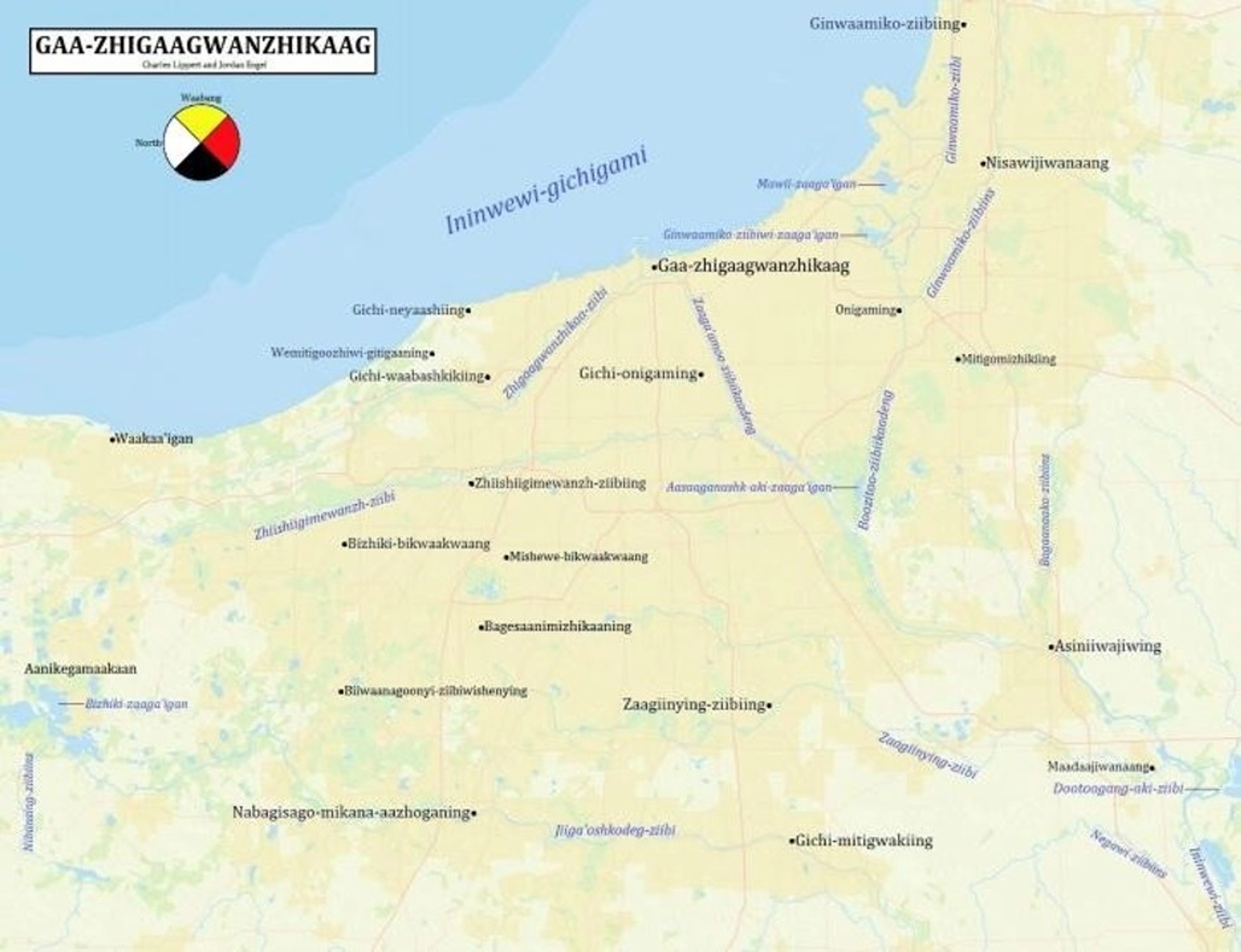
The Decolonial Atlas is one of my favorite projects of all time so I hope you explore and become inspired. See the world from a new perspective — literally.