Navigating Geographic Challenges in Products: How South Korea’s National Security Concerns Affect Interactive Maps

As an intelligence analyst, I wrote a piece about this six years ago to provide background for travelers headed to the Olympic games in Seoul, South Korea. Knowing what I do now about product management, I know there are additional ways to assist customers besides having them bookmark important pages ahead of time.
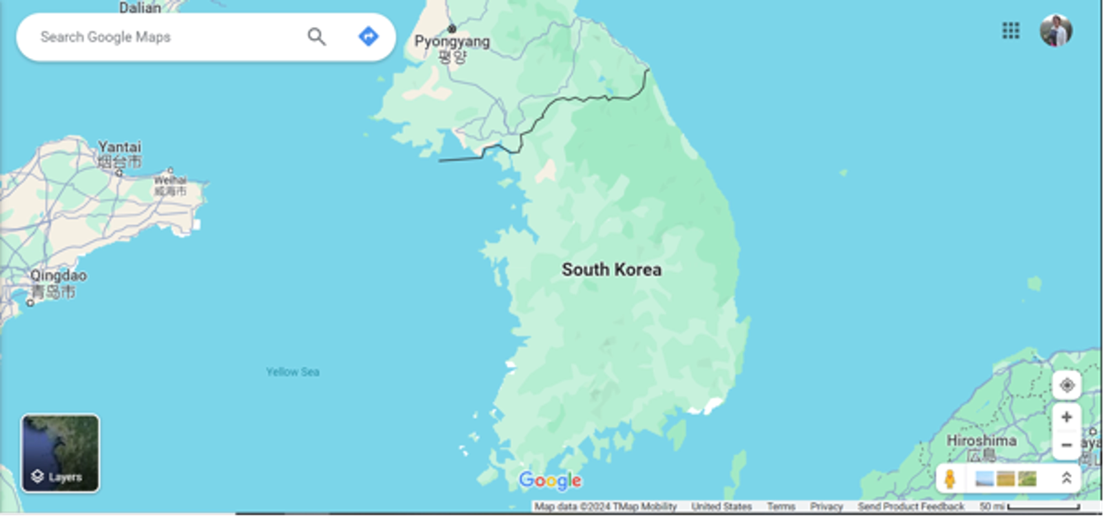
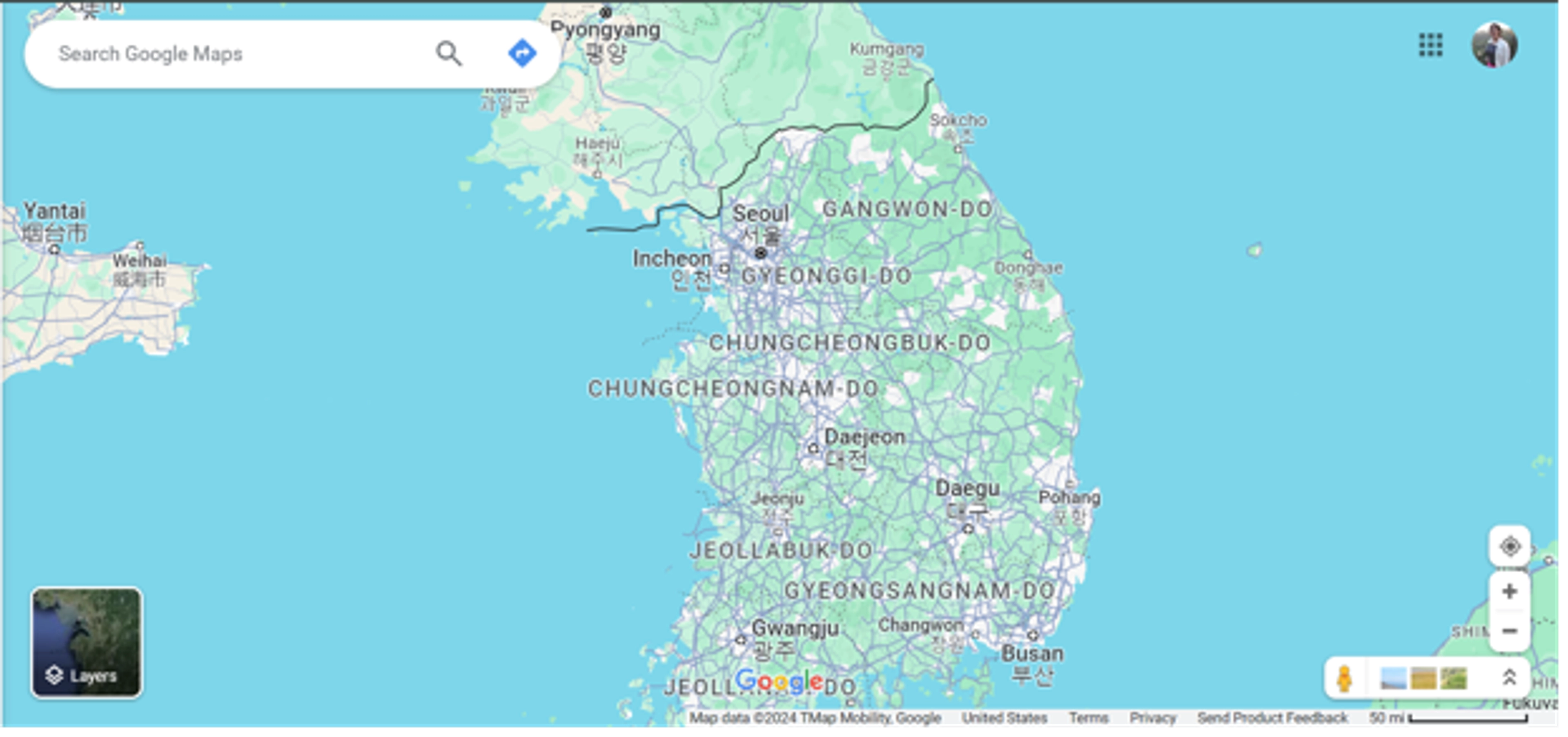
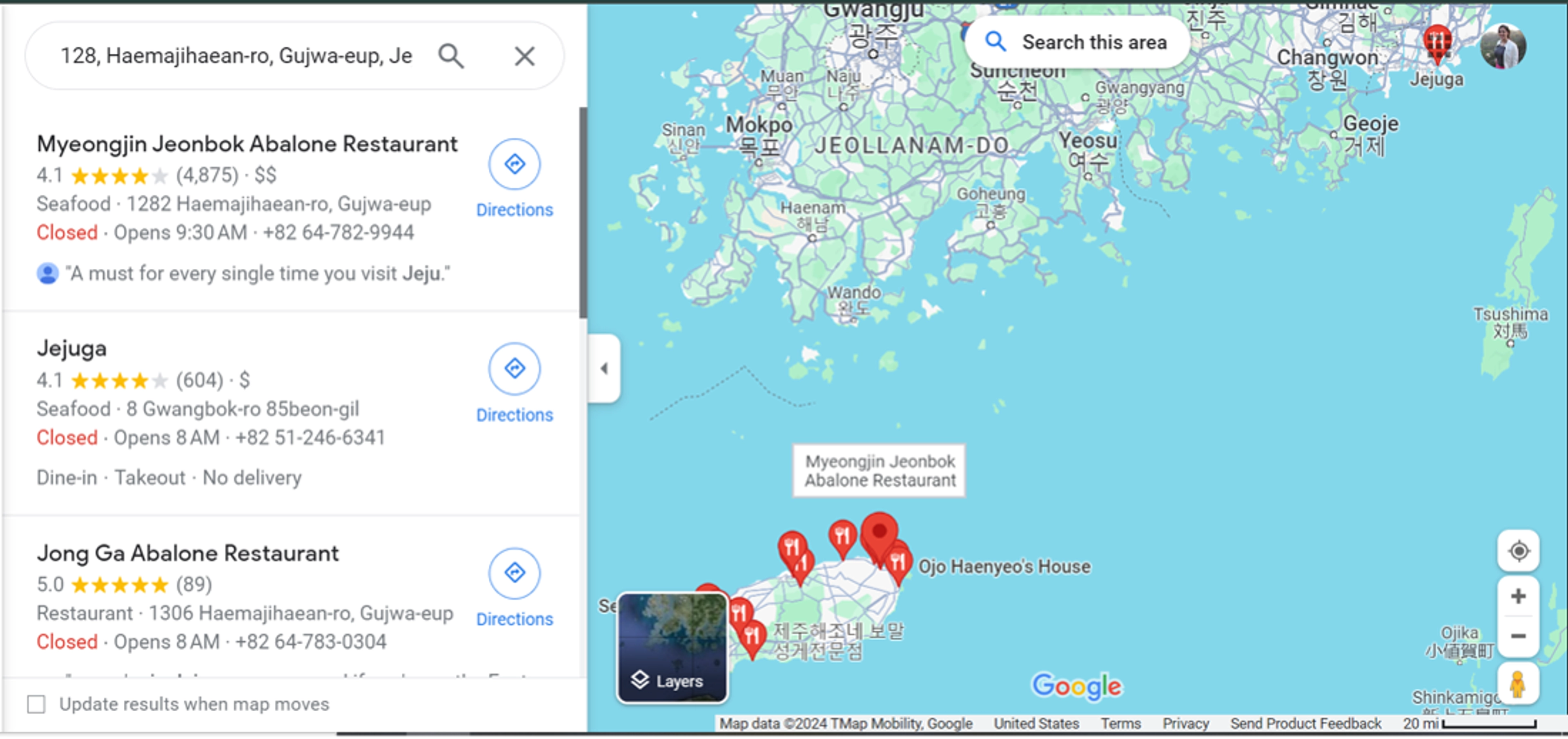
Quick background: two of the most popular international mapping platforms, Google and Apple, do not provide complete coverage of South Korea due to the nation’s strict security laws. How incomplete? In the screenshot of the Korean Peninsula below, notice how there are even more roads visible in North Korea than in South Korea.
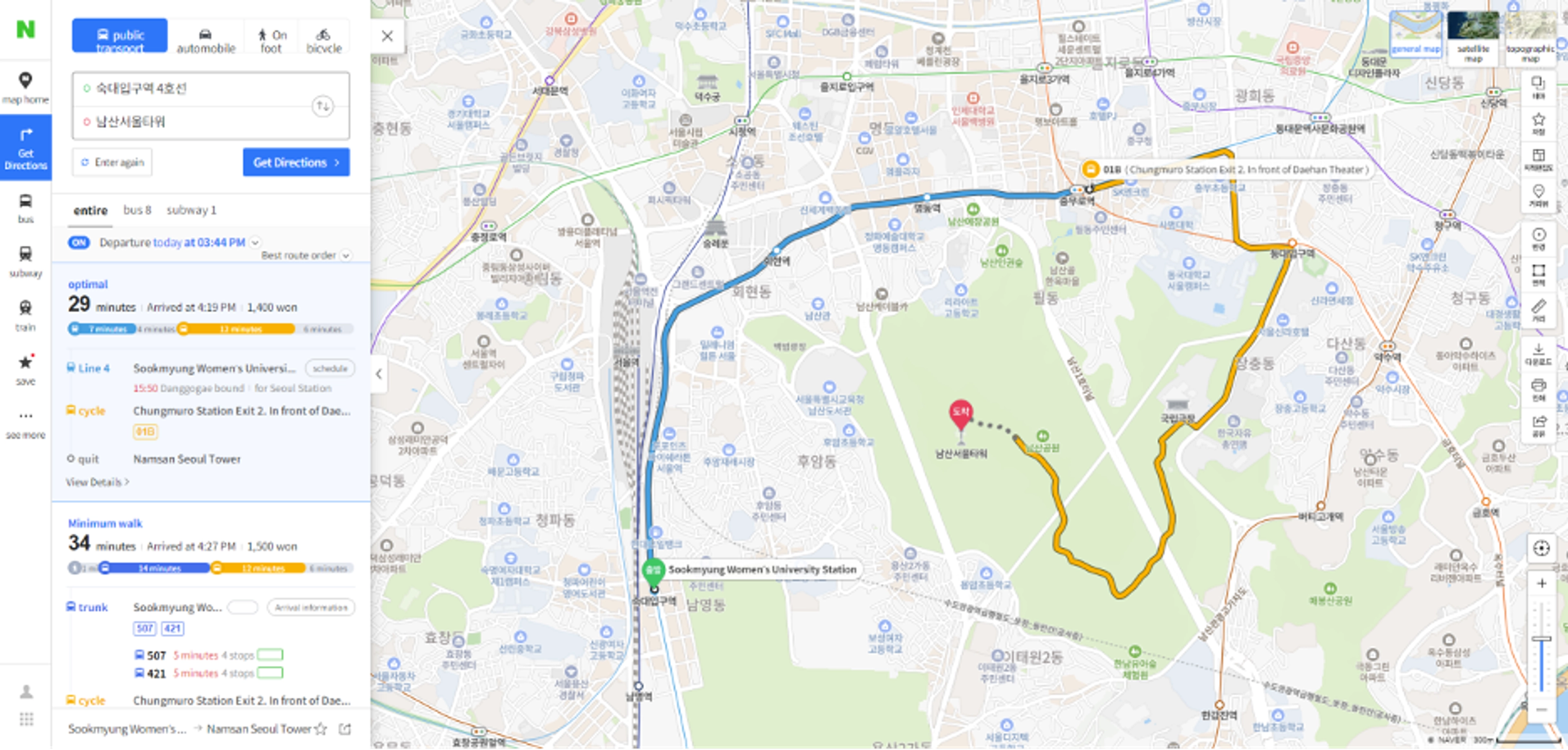
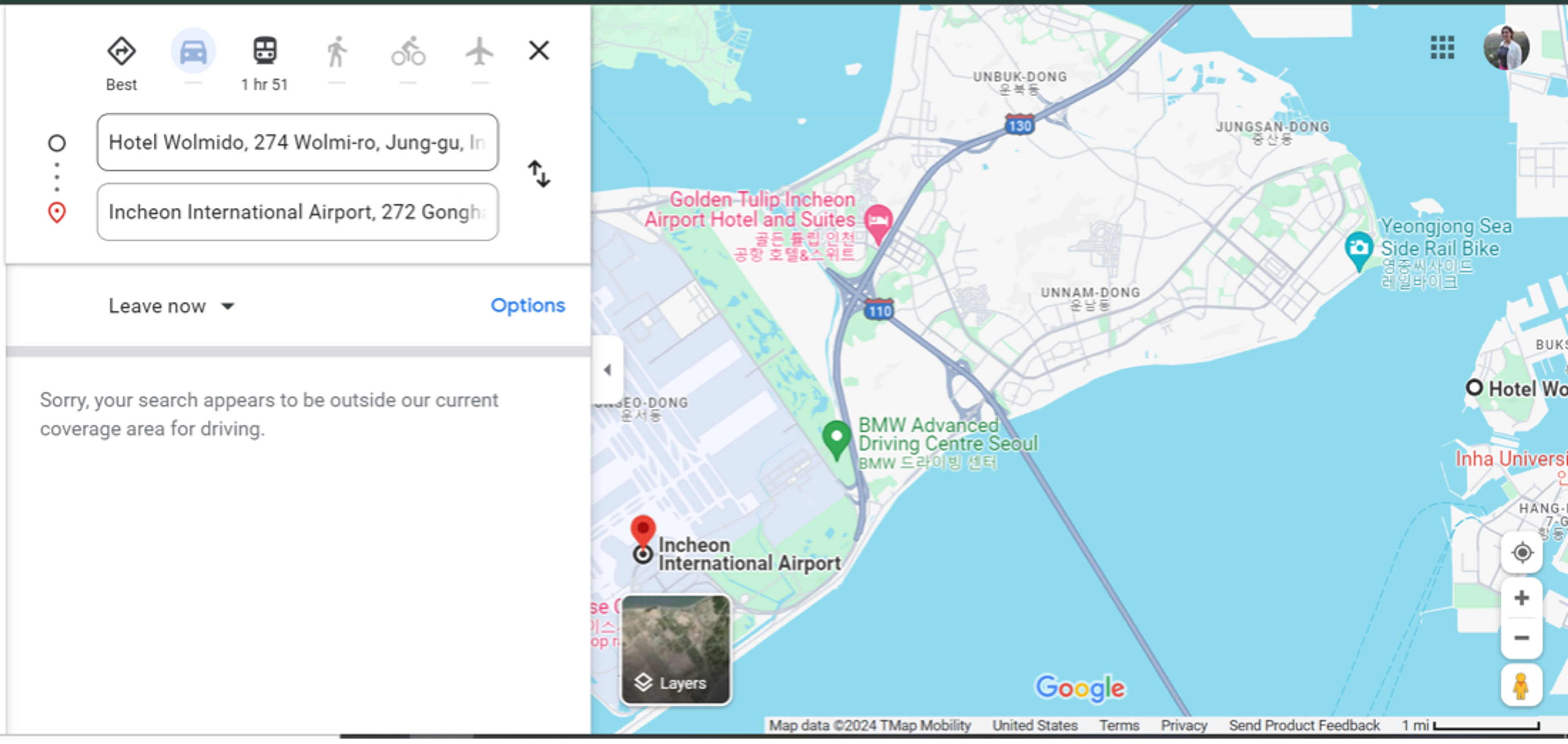
If you click on a South Korean map location, some limited information will pop up but there’s no navigation. For example, you can see transit routes but not get driving instructions.
Other limitations include:
- For South Korea, you must zoom in further than for other nations in order to view road details. This is because the platforms need to generate their own road classification system instead of using the one the government maintains.
- Transit routes are visible because those websites are publicly available for reference. However, navigation calculations for driving are not available, nor are biking and traffic overlays.
- Because native platforms are being used, most places will have incomplete information that relies on public input.
- Even with an exact address as provided by a business, geolocation search will have a hard time identifying the location.
National security laws prevent foreign companies from using complete navigation features and exporting government-supplied map data. This severely limits the information shown and the ability to interact with the map. Google legally challenged these restrictions in 2016 as they had applied to export the map data multiple times since 2007, and Apple tried in 2023, but in all cases, the government denied the requests on the grounds of protecting national security. So what’s a product manager to do?
You have the following options:
Continue using your non-Korean map products with your Korean audience
Unfortunately, the major map providers do not give users any indication about the limitations of their map capabilities, so consider adding one yourself if your users select a location within South Korea (based on ISO code, bounding box, etc.)
If your customers need navigation information you will need to get clever about combining your non-Korean basemap with Korean-based navigation services. Ensure you’re checking the terms and conditions appropriately as not all mapping products work with each other.
Switch to or incorporate Korean-based map products
Korean-based users expect the use of a domestic mapping product, such as Naver Map or Kakao Map. Depending on your product, you can have these maps automatically set for your users based on location data, organization preference, or in a basemap toggle that’s always accessible.
These products also have international coverage, so consider using them as your primary map with a language preference that makes sense to your customers.
In summary, don’t expect your users to carry the burden when using non-Korean map products to acquire Korean location information. Don’t expect them to save bookmarks ahead of time or navigate between multiple pages to grab a business name in Hangul, paste it, translate the steps, etc. You need to do the heavy lifting and provide an in-app solution that makes sense from a business perspective while balancing ease of use.